

Some books, through being perfectly functional and factual, give tremendous scope to the imagination: one such might be Bradshaw’s Railway Guide – so beloved of Sherlock Holmes – which (because it gives such a clear and detailed picture of the possibilities of rail travel) is celebrated as much for its use by the fireside traveller, dreaming of journeys that might be made one day, as for its practical employment. Two books that greatly influenced my cycling adventures belong in the same category:

Both are the work of the same man – Harry R G Inglis. They look modest enough, yet you would be hard put to it to find any book more brilliantly conceived or more complete in the realisation of its original idea than The Contour Road Book (to which Hill Path Contours is a supplement).
Consider – it is the beginning of the 1890s, and with the advent of the safety bicycle (and the motor car still in its infancy) the cycling craze is at its height – what could be more useful than a compact volume which gives details of the various routes a cyclist might wish to attempt? Naturally, it should have maps, showing each route in its place; and of course there should be a detailed description of each one, with useful information about distances, road conditions, places to stop en route and sights worth seeing, together with useful general information about place-names, lighting-up times, transport costs and features of geographical and historical interest, etc.; but it is the additional link that Inglis supplies between the maps that show the route and the verbal description of it that is the true stroke of genius – a profile or elevation of each route, derived from the contours of the map, and linked to the description mile by mile.
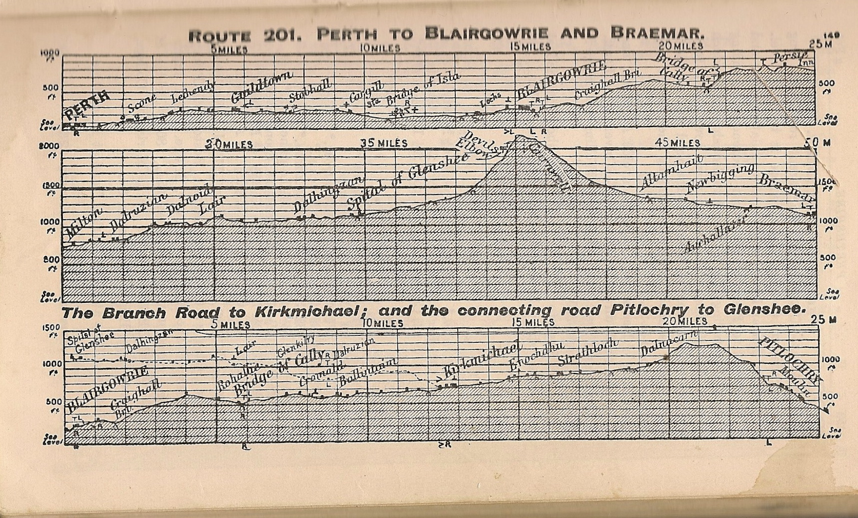
These days – about 120 years later – computer-generated profiles are all the rage with runners, cyclists and motorists – but Inglis did his by hand from maps, a real labour of love. According to the preface to the first edition – published in 1898 – it took him eight years. That means he conceived the idea when he was about 21. We know that he was a keen mountaineer; my guess is that he was also an enthusiastic cyclist. When you study the Contour Road Book, you can almost see the idea of it forming in his mind. The durability of his conception is borne out by the fact that I first encountered the book in its twenty-fourth edition, published 1963. Here is his account of the Perth-Braemar road, which includes the famous ‘Devil’s Elbow’ and the Cairnwell Pass, the highest main road in Britain:

That said, it was actually Hill Path Contours that set me dreaming first:

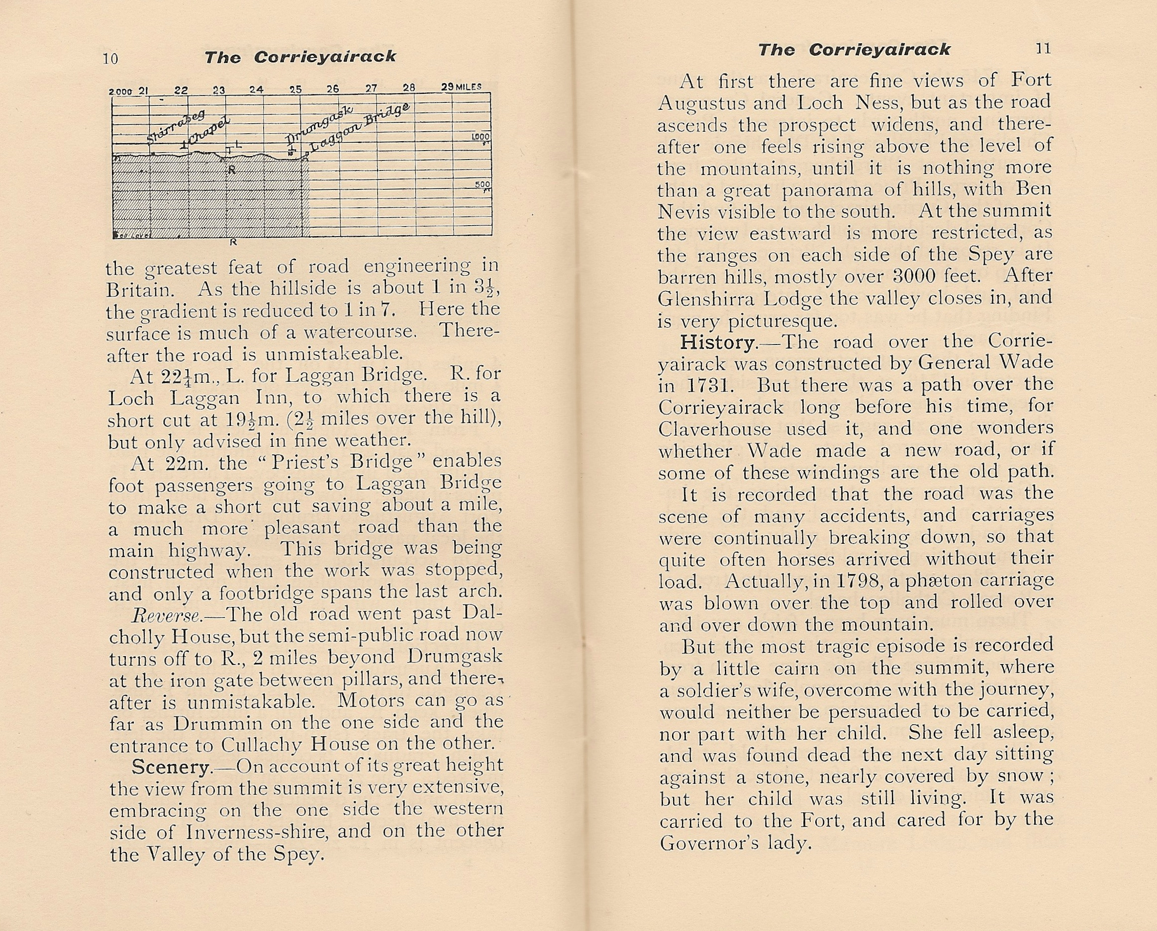
Who could read that and not be tempted by the urge to go there? I could not: my first long-range solo excursion (more than thirty years ago) was to cross the Corrieyairack; the next, undertaken the following year, was the traverse of Rannoch Moor:


[An account of these journeys will be given here in due course, when I get round to it – you will note from Inglis’s text that taking a bicycle on either implies a certain degree of perversity]
To these two prime sources of cycling dreams and adventure I must add a third, the Ordnance Survey 1:25,000 (2½” to the mile) series maps, which I first encountered in their blue (first series) form and the larger-area green ‘Pathfinder’ form:

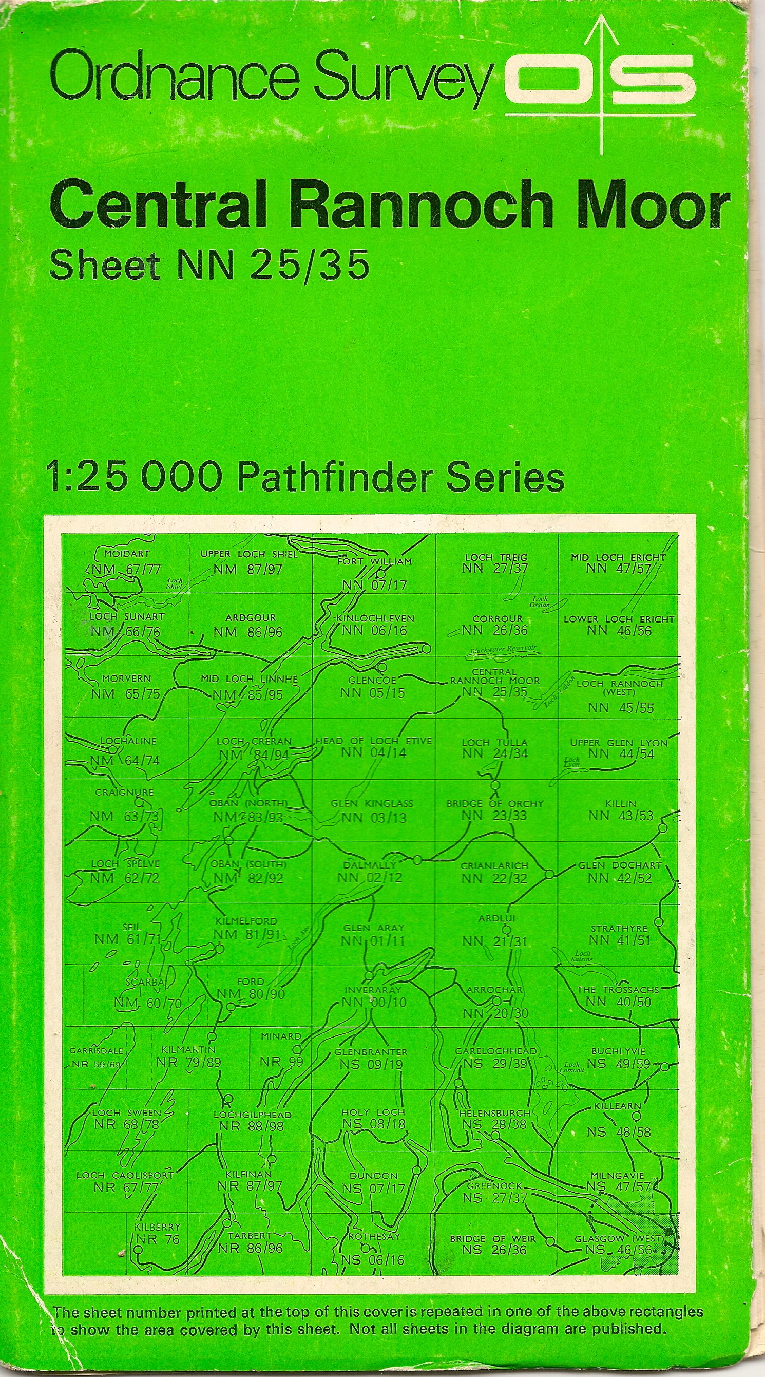
These are now available in the splendid, even larger-area, Explorer series, the cyclists’ map par excellence – proof that some things at least do actually get better:

